

Scanned Deed to Database: How ODOT Turned Its Land Records into Usable Data
ODOT had decades of scanned deed records and no practical way to use them. Phase2_Land is the purpose-built solution that finally changed that.
.png)
"The pilot Phase2 completed in one of our counties was nothing short of incredible. They took decades of scattered deeds and transformed them into a clear usable GIS layer that finally showed our property in a way we could truly understand. If this is what they can do in a pilot, we can only imagine the impact of the full project. An incredible company with a talented staff doing remarkable work."
– Ken Phillips, Chief of Right of Way & Utilities, ODOT
The Challenge
The Oklahoma Department of Transportation had decades of right of way deed records, but no practical way to use them. Hundreds of thousands of documents had been scanned and stored as PDFs, bundled by job folder rather than organized by deed. There were no separate files, no structured data, and no spatial representation of what ODOT actually owned. Previous attempts to solve this had failed. OCR alone couldn't handle the complexity of historical deed language, ambiguous metes and bounds descriptions, or the inconsistencies introduced by surveyors working in the 1930s, 40s, and 50s. The problem wasn't just technical; it was operationally impossible at human scale. To manually read, categorize, and catalog the volume of records across an entire state would take an estimated 50 people, 30 years. ODOT came to Phase2 knowing the problem was complex. They needed a partner willing to take on a problem that had never been solved before.
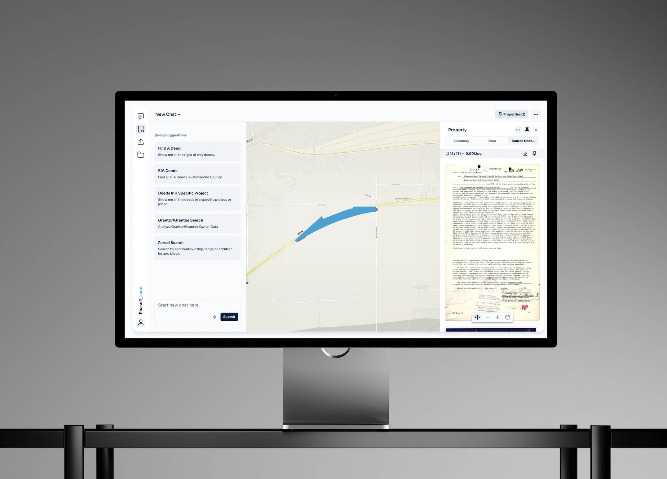
Phase2_Approach
Phase2 engineered a purpose-built AI pipeline (not an OCR tool) to take ODOT's raw scanned documents and transform them into structured, spatially accurate, source-linked data. The first challenge was separation: extracting individual deeds from massive bundled PDFs using vision models and a council of AI agents working in coordination to improve accuracy. From there, the pipeline parsed the metes and bounds legal descriptions in each deed — turning dense paragraphs of directional instructions into structured coordinate data, bearing measurements, and landmark references. The hardest part wasn't extraction. It was resolution. Historical deeds are full of ambiguity: vague starting points, imprecise measurements, descriptions that reference landmarks long since gone. Phase2 approached this as an optimization problem, building a solver that could take ambiguous variables, apply known constraints (shapes can't self-intersect, landmarks must be hit, the closing distance must be minimized), and resolve them into an accurate spatial shape. The result closely mirrors what a trained human would do, but at a scale and speed no human team could match. While staying true to the specified contents of each deed. Every result is deep-linked back to its source document. Alongside each generated shape, Phase2 extracts and structures the full metadata record: document and project IDs, grantors and grantees, tract and parcel details, and complete legal descriptions. That metadata travels with the spatial data, making it queryable inside a GIS platform or through Phase2_Land's custom agentic AI interface. The output integrates directly with your GIS tool of choice and can be delivered as a static import or a live PostGIS API connection for ongoing use.
Phase2_Result
The pilot processed over 600 deeds from a representative sample of ODOT's portfolio, producing a clean, usable GIS layer that showed ODOT its own property in a way it had never been able to see before. Decades of scattered records became a spatially accurate, queryable dataset, linked to source, ready for Right of Way, Legal, Real Estate, and GIS teams to act on. Phase2 has now built the foundation being used to scale across the state of Oklahoma and beyond. Learn more about Phase2_Land here.